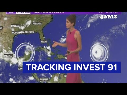
We're getting close to the peak date of hurricane season which is September 10. The tropics remain fairly active. Hurricane Larry continues to churn across the Atlantic Basin and is not an immediate threat to any land for the next several days. Invest 91-L is over Mexico's Yucatan Peninsula and may bring some tropical moisture to our area next week.
LARRY
Larry is a major hurricane over the warm Atlantic Ocean. It will hold on to its hurricane strength for a few days. Its projected path is to the north around a ridge of high pressure, so that would keep it far from the US and maybe even east of Bermuda. It is not a concern for our area at the moment (and likely will not be).
INVEST 91
Invest 91-L is a broad low pressure area with a few showers and storms over Yucatan. Models show this disturbance drifting into the Gulf and possibly getting drawn just east of our area midweek.
There will be dry air plus wind shear in the Gulf this week, so it's a fairly hostile environment for tropical development. Of course, we'll watch it closely. Right now we're mainly expecting it to be a rainmaker for us Tuesday and Wednesday with 1-3 or so inches of rain possible. We'll keep you updated.
0 Comments